South Africa - Kenya - England -- December 2006
photos by G.P. Jones using Nikon Coolpix 4300 digital camera, except where noted
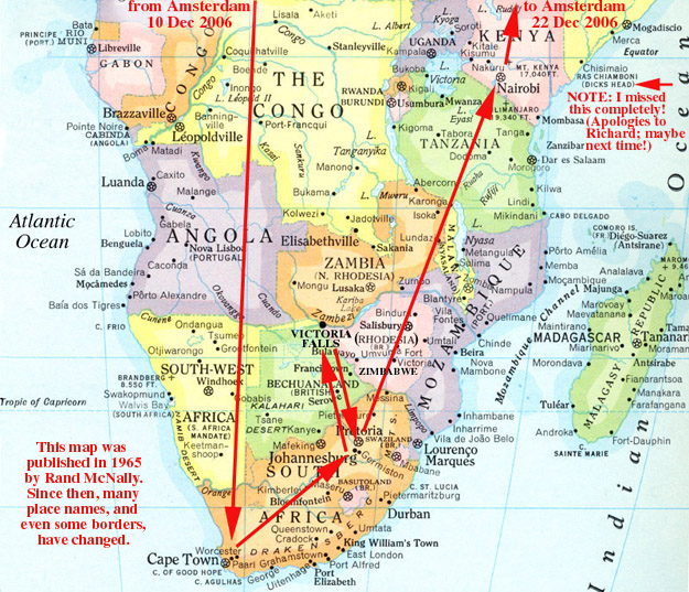
Arrived Cape Town 10 December. Luggage arrived 13 December.
Cape Town -- 10-16 December
Having seen this magnificent city, I am convinced that this
is where God will come if she ever decides to retire.

This postcard gives the best orientation to Cape Town's signature feature: Table Mountain

Photo taken from the top of the Cable Car ascent to Table Mountain
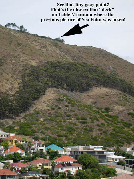
Photo taken from the top of the Ritz Hotel in Sea Point, looking back at Table Mountain (only the tip is visible over the Sea Point hill)

Cable Car ascent to the top of Table Mountain.
This is my favorite picture of Table Mountain. Notice the clinging clouds. This was a feature of many of the mountains around Cape Town, as further photos will show. I heard that the French called this "The Wig".

Ritz Hotel, Cape Town, with its well-known revolving restaurant called (what else?) "Top of the Ritz".

This shows most of the nearly-180° view from my room. Scroll right to see the whole picture.

Sunset from the west-facing Bar in the "Top of the Ritz" restaurant.

This and the following pictures were taken from the "Top of the Ritz" restaurant tables.


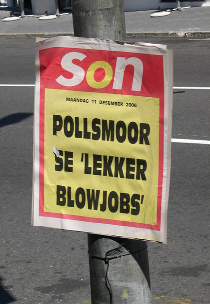
Newspaper headlines are posted as placards, like this one, obviously to sell papers. If you don't read Afrikaans, you can't be offended, I suppose. If you do, my apologies (I think).

What, that *&$#% place again?

Very very punny!
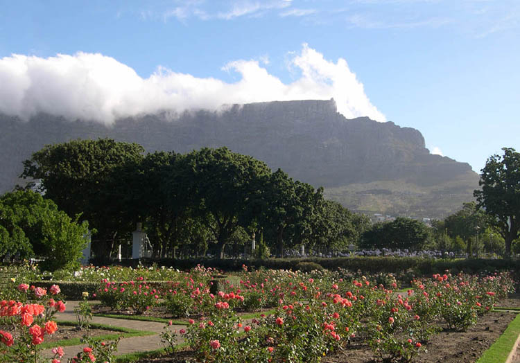
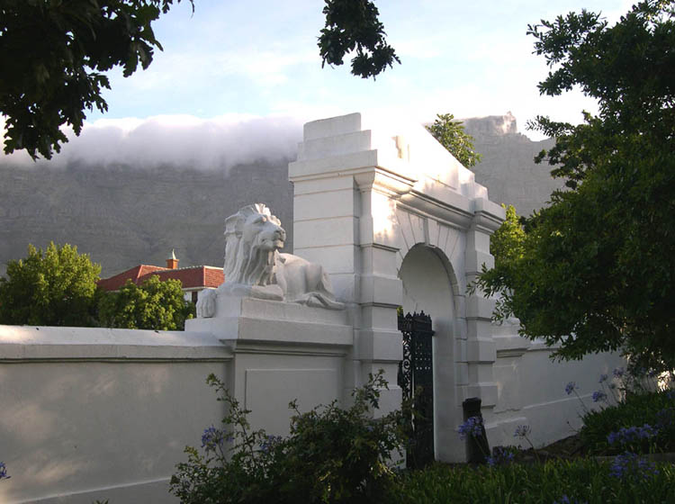
The Dutch East India Company basically built Cape Town in the early days. They established some very extensive gardens in the Centre City, which were later donated to the people of Cape Town. This is a view of Table Mountain from "The Company Gardens", just steps away from the Government Buildings and the Cathedral where Nobel Peace Prize Winner Archbishop Desmond Tutu preached during (and after!) Apartheid.

I did not sample this delicacy.

Sea Point District and Lion's Head (the point at the right).

As far as I'm concerned, the obligatory "tour" while in Cape Town is a trip down to the actual Cape of Good Hope and Cape Point (as you can see from the map, those are two different points). The trip can be done in a half day or whole day package. I took the whole day, so as to see some of the other points along the way down and back. For example, I didn't expect to see a Penguin Colony so far from Antarctica (it's on the map just below Simon's Town on the East coast of the Cape Peninsula; see penguin pictures below).

The views from the bluff overlooking Cape Point across False Bay (so called because it really is just a big bend in the coastline at the bottom of the continent) are as good as any in Cape Town. Here we look East toward Buffelstalberg and the Indian Ocean beyond. Note the clinging clouds!

Cape Point.

Marker sign at the Cape of Good Hope. The Cape is significant because if you're sailing Westward around the tip of Africa, this is the first point where you can begin sailing North, and vice versa for an Eastward journey. The sign notes the latitude of the Cape: 34° 21' 25" South. This is almost exactly the same latitude South of the Equator as Los Angeles is North.

On the return from the Cape our tour visited the Penguin Colony. "Sure", I said, "I'll look at some penguins." What I didn't think about was the fact that it was 27°C (about 81°F) and it was still a week until the beginning of summer. No snow, no ice, but Penguins? Well, yeah.

No, there's no snow or ice in this picture. What's under the penguins is sand, and what's on the rocks is, well, you know.
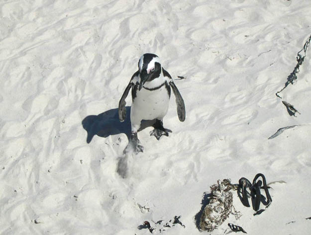
George.

George's friends and family.

"What's a nice penguin like you doing . . ."
Penguins are monogamous for life. There's a joke here about gay marriage, but I can't quite figure it out.
Cape Town to Johannesburg by Overnight Train
16-17 December
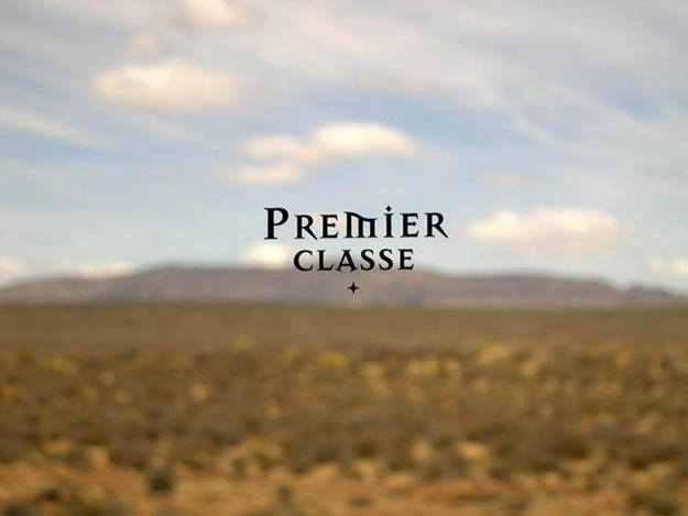
When planning this trip, I learned that South Africa is pretty famous for its luxury trains. The top of the line is the legendary Blue Train, often described as a moving 5-star hotel, and compared with the Orient Express. The price tag matches its reputation. I opted for the Premier Classe, a very affordable (US$265 one way) and still very elegant trip.
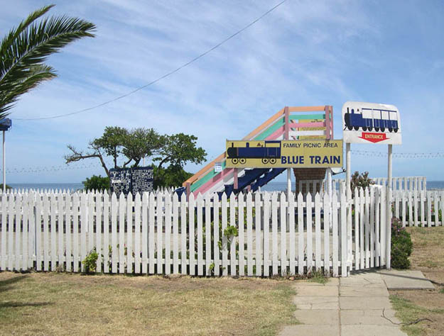
First, the Cape Towners little joke. On the open-top sightseeing bus around town, just as we were rounding the bend toward the Mouille Point lighthouse, the guide told us we were about to see the legendary Blue Train. Ha, Ha.
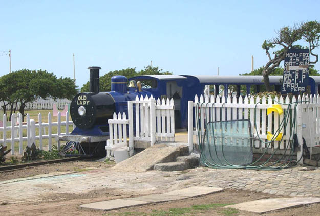

The route taken by the Premier Classe (and virtually all trains between Cape Town and Johannesburg) is the century-old railway that ultimately extended all the way from Cape Town to Cairo. (Below you'll see a picture of the famous Victoria Falls bridge between Zimbabwe [formerly Southern Rhodesia] and Zambia [formerly Northern Rhodesia] which is also part of this railway route, beyond Johannesburg, of course.)

It wasn't the Blue Train, as you can see. Someone made the comment that it was halfway between a (regular) black train and the Blue Train. OK.

The details were impressive. This was the head rest found on each seat.

Compartments were comfortable. This was mine.
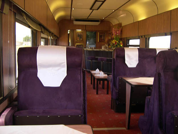
Dining area.

Bar (seen in the background of the previous picture).

Dining table. In the middle of the window, you can barely see a tiny "Premier Classe" logo. The next picture shows it close up.
Again, the details were impressive.

Talk about important details. This was one of those older trains, like we used to ride on the East Coast in the early 1970s, where the drains empty directly onto the tracks.

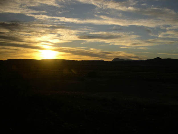
The train made one stop where the passengers could get out and go for a walk.
This is Beaufort West (not BEA RT WES, as the sign says).
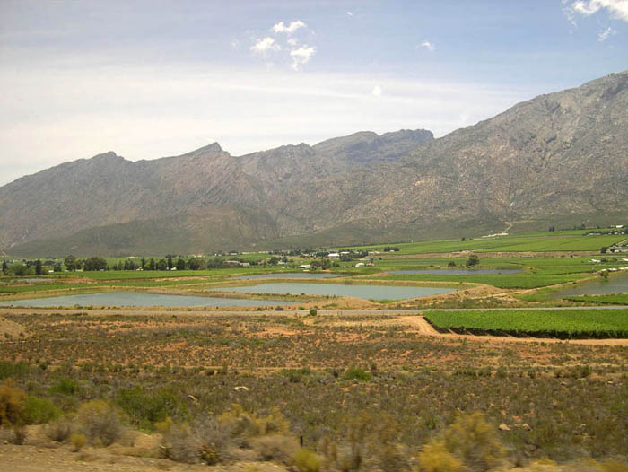
The middle of Nowhere.
Two-Thirds of the way through Nowhere.
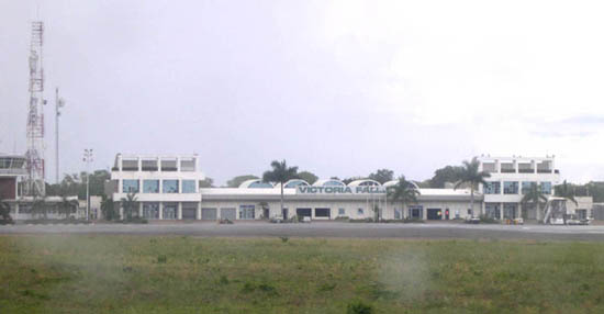
Victoria Falls -- 18-19 December
After a night in Johannesburg (actually, the suburb of Sandton), the time comes to visit Victoria Falls, the centrepiece of the trip for me.

A fond GoodBye from a Johannesburg Airport T-Shirt shop.
Unfortunately, getting from Sandton to Johannesburg Airport (JNB) proved nearly impossible in a rental car. The roads were clearly marked and seemed like major highways, but many didn't show on the map.

Late to the airport, my British Airways flight was finished boarding and closed, so British Airways put me on Air Zimbabwe (at no extra charge!) to fly an hour later.

Yes, that's a propeller engine!

I don't know . . . something about using a lifesaving "pontoon" struck me as funny. Or maybe it was the fractured English of "Pad be used . . ."

Northern Zimbabwe was much warmer and more humid than Johannesburg, and had better clouds.
It was obvious right away that this was not Johannesburg any more! The word "outpost" comes to mind.

"Dr Livingstone, I presume?" Give me a break. How else would you caption this picture!?

Native Africans (who of course were there long before Livingstone "discovered" the site) called the Falls "Mosi-Oa-Tunya" -- The Smoke that Thunders -- as noted on this plaque near the Western entrance to the scenic walkway not far from the Livingstone statue, shown above. The walkway winds through a rain forest created by the constant spray from the falls, and continues along the gorge to the bridge to Zambia over the Zambezi River (see below).

There is no way to describe Victoria Falls, and there is no way to photograph the Falls in a single shot, either. The scene is simply too gigantic. Even "awesome" falls short (no pun intended). Here you see the overview, from the Zimbabwe side looking East toward the Zambia side, with the rain forest just across from the Main Falls, and the Zimbabwe/Zambia bridge at the right edge of the postcard. You're looking at more than 1700 metres (over a mile) of waterfall. Even this view is inadequate, because the spectacular Devil's Cataract faces away from the camera and is mostly hidden by trees.

This was my first view of "The Smoke that Thunders", but I had heard the Thunder long before, and had seen the Smoke (mist) even from the airplane 80km away.

Nice photos are easy to take almost anywhere at Vic Falls, but again, probably no single photograph has ever captured the entire wonder of it all. For example, this is probably less than 5% of the Falls width.


Devil's Cataract, Western edge of the Falls.

As you could see from the postcard photo at the beginning of this section, this is not a waterfall that falls into a valley (like Yosemite). The earth simply opened up at this point creating a gorge for the continuation of the Zambezi, while leaving cliffs on both sides. This makes it possible to view the falls from just about 40 metres away, across a relatively narrow gorge. It also is one of the reasons it's impossible to photograph in its entirety. Either you get the wide view (and leave out the bottom 3/4 of the water) . . .

. . . or you get the depth, but only a narrow portion of the massive width.


This sign is at "Danger Point", which is apparently the actual name of the place.

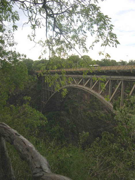
Bridge over the River Zambezi.
Zambia is on the other side, but limited time (and tensions between Zambia and Zimbabwe) kept me from crossing over. There is quite literally a "Stop" sign and a guard station at the middle of the bridge!

Mosquito netting in the Mercure Rainbow hotel in Victoria Falls, but I didn't need to use it.
Anecdote 1: They were charging people ZWD8000 (about US$32) for each drink at the poolside bar if charged to the room, and about US$12 if you paid cash. I watched a very funny scene for quite a long time between a French woman who didn't speak English (or Swahili) who wanted to order a drink, but didn't want to pay in ZWD (Zimbabwe Dollars) or US$, but tried to pay in Euros, and then couldn't believe how much they wanted so began bargaining! One of the security guards at the hotel came to help, as he spoke French, and then it really got interesting!
Anecdote 2: When I arranged for the transfer (taxi) back to the airport, the agent used carbon paper to fill out the duplicate form (older readers will know what "carbon paper" is), and when she finished, she took out some regular staples, then inserted one of them by hand to attach my receipt to an information sheet. Another reminder of just how far away from Johannesburg we were!
Nairobi -- 20-22 December
I went to Nairobi on this trip simply because I couldn't imagine
a trip to Africa without it.
It was a very good decision.

On seeing this departures sign in the Nairobi Airport, it suddenly struck me just what exotic destinations were offered from this legendary city.
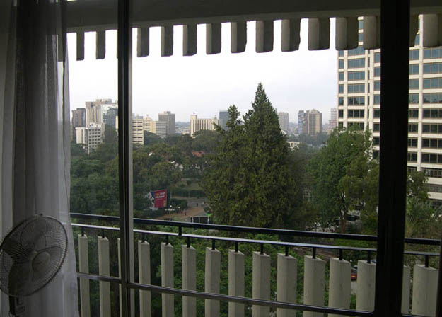
The view from my room in the Panafric Hotel, looking toward Nairobi's centre. (Notice I keep using the classy African [British] spelling of "centre". Quite honestly, nothing else seems appropriate!)

Nairobi is Equatorial Africa, but its elevation keeps it temperate. Beautiful weather.

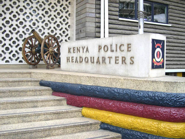
This is one serious Police Station!

I have a story to tell about this Mosque at the left; the towers on the right are, of course, another building, but make an interesting juxtaposition. For the Mosque story, it's too long for this Web page, so ask in person sometime if you're interested.
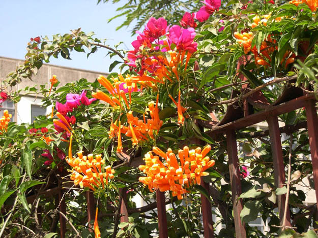
This picture is just for Peter D., who seems to like flowers a lot.

Bridge in the enormous Uhuru Park, very near the Centre City area on the Uhuru Highway, between Haile Selassie Avenue and [Jomo] Kenyatta Avenue.

Art Deco building.

On a walk off the "beaten path", I found the railway station with this curiously named office.
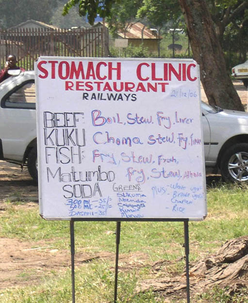
On a dirt road from the railway station to the Railway Museum, I happened upon this unique restaurant.
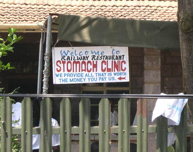
Too bad I had just eaten.
England (Manchester) on the Way Home - Brief Postscript
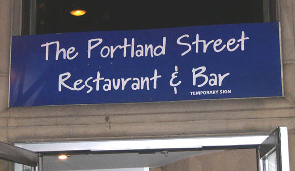
Only in England would they tell you it's a "temporary sign".

Manchester City Centre map.
Am I the only one who sees a horse here? With a tiny cow on its head?